Traveling for the first time on a scenic byway into the Sierra Madre mountains! Ever heard of them? Well, the truth is there are mountains with this name, meaning "mother range" all over everywhere. Most famously in America, you would expect to find this byway in California!

Photo: Battle Pass Scenic Byway, Wyoming State Highway 70
Nope ... We are going to be crossing the Continental Divide. While crossing Battle Pass in the Sierra Madre mountains of southeastern Wyoming, not California. Going down a stretch of highway, while at least paved, is one of the most remote on which I have ever traveled.
Before taking a closer look, these are two maps of the area:


Map of Area Covered in this Post
Here is a brief look at each of the highlight points illustrated above, with links to more information, if you are interested in learning more about it:
- Spirit West River Lodge, from which I left to make the trip written about in this post.
- Battle Pass, crossing the Continental Divide at 9,955 ft (3,034 m).
- Road to Savery, dropping ~3,500 ft (1,067 m) to Savery at 6,473 ft (1,973 m).
- "Aspen Alley" and the Road to Rawlins, traveling the backside of the Sierra Madre mountains.
Let's be on our way! 😎

Battle Pass
Having driven through the mountains of the American West all of my life, I was looking forward to experiencing a new pass. Especially one on the Continental Divide.
Ascent to Summit
First, we have to get there ...

View looking northeast to Enterprise River Valley, with the Snowy Range in the background


View looking southeast to the Huston Park Wilderness, with the Mt. Zirkel Wilderness in the background

Viewing final steep stretch to the summit, on Wyoming State Highway 70


Photos: Scenes driving to the summit
I find it very worthwhile to stop and look at the signs along the highway. I like details and believe the information shared is normally worthwhile. And ... It is always good to get out and stretch!
View from the Continental Divide
Well, I made it. What was there to see, from this remote vantage point?

View of the "tippy top," from which the next photos were taken

View looking east, to the Snowy Range. Note fire in upper right, in the background.

View looking west, to one of the most remote regions of the American West.
Photos: Continental Divide at Battle Pass
I have crossed the Continental Divide countless times over my lifetime. There is something very special about standing on it and realizing all the water on one side is going to flow down ultimately into the Atlantic and the other side down into the Pacific.
Since I know this part of our country so well, I already know exactly where this water is going. East into the Mississippi flowing into the Gulf of Mexico south of New Orleans. West into the Colorado flowing into the Gulf of California in Mexico.
Note: In the middle image above, we see one of the saddest views found in nature - a fire! What we are looking at is the latter stage of a massive fire - the Mullen Fire.

The power of these destructive forces is almost unimaginable. I had driven into the area the previous evening in an absolute downpour of hail. Not rain. Hail! For like two hours. I knew about this fire, before heading out on this trip. I thought the totally unexpected hailstorm would most definitely put it out.
How did that turn out? We can see the answer in the middle photo above.
As stated above, I believe the information found on some signs is very informative. Very useful.


Photos: Informative Signs on the Continental Divide at Battle Pass
This road used to provide passage back and forth to a thriving frontier "boom town" with a population of ... 250!

Road to Savery
If one looks closely, at the last picture above taken on the Continental Divide, you see the road way down below on the far right. It descends very rapidly down the western side of the Sierra Madres.
The first stop really stood out, though!


Photos: Views looking down at Battle Lake
Getting out to enjoy this beautiful high country lake, I was stunned to read this sign. Thomas Edison was famous for his many inventions. Based out of where? Menlo Park, New Jersey.

Source: Directions on how to get from Edison (Menlo Park), New Jersey to Savery, Wyoming on Google Maps
It is not a simple trip even today, to get between these two locations. But in 1878? Not only did he not have Google Maps ( 😱 ), he didn't even have a private jet! Or a 4-wheel drive truck! Not even a ... "horseless carriage!" 😲
Nope.
Well, at least the First Transcontinental Railroad had been completed by 1869. But, it doesn't get anywhere close to this area. He likely got here the old-fashioned way. Rode a horse? 🤷♂️
To do what? At the ripe old age of 31, he was already known as "Professor Edison" and was out here with a friend to see a total eclipse of the sun. Where best viewed? Somehow, in that era, everybody decided the place to be was, of all places, Rawlins (see below, in this post), Wyoming!
Afterwards, he decided having come all this way, he might as well go on a fishing trip! The rest of this remarkable story, along with details about how this played a role in his invention of the light bulb, can be read here.
Well ... That was totally unexpected, but a lot of fun.
Next time you turn on a light,
maybe you'll think of
this post!
maybe you'll think of
this post!
Hahaha ... 😉
Moving on down the road ...


Uhhh ohhh ... Vultures circling is never a good sign


Cattle all piled up against a gate waiting for ?...? 🤷♂️

Very hard folks out here are mostly descendants of the original homesteaders of the late 1800s

Final descent down into the Little Snake River valley (covered in next post)
Photos: Views down a very remote road in the American West
It was amazing to me to find this highway paved. There are so few people living out along it and you have to go way out of your way to get here. As it is not on the way to anywhere ... Not for most people, anyway ...
I sure enjoyed it, though!

Backside of the Sierra Madres
Not remote enough yet? On the return trip, having done some research where I learned about "Aspen Alley" ...
I decided to add a couple of hours to my trip and take an even less "road less traveled" and turned north off onto Country Road 801! And was immediately on a gravel road ...
"Aspen Alley"
My whole life our family has enjoyed what is commonly referred to as the "aspen belt." Not too far down in the valley, not too far up near the peaks, but in a band higher up across the Rocky Mountains, you will find these wonderful trees.
And I am on this trip at a particular favorite time of the year. Their leaves are turning all of their various shades of yellow, orange, and red!
Let's check out this local attraction.

The most famous picture of "Aspen Alley," definitely not what it used to be ...

Love this type of fence ...


View looking east, toward the Sierra Madres, with the Continental Divide running along the ridge

Oh my goodness ... Another vehicle coming!!
Photos: From one end to the other, of "Aspen Alley"
While I enjoyed experiencing this stretch of mountain road for the first time, I was a bit disappointed. It was clear to me this section of road had seen better times. The trees just did not seem particularly healthy. In some cases, they were dead.
Due to drought? Something else? I do not know.
Road to Rawlins
In the last picture above, we see the road about to break out of the aspen belt and into the open high plains for which Wyoming is famous. The amazing corollary to that is the road suddenly turned back into a paved road. About where you see that vehicle down there!
As you are about to see, this stretch of road is unbelievably isolated. I cannot imagine the cost of paving this road, so far away from anything. And for what? 🤔🤷♂️
Let's go find out ...

Many of the ranches harken back to the days of the original homesteaders. They are huge!


From Lynn Finney's (owner of Spirit West River Lodge) description, around behind these trees is where she worked as
a little girl on a guest ranch. Who owned it? Not her father. No, she learned her "trade" early in life, with her grandfather!

Receding waters of High Savery Reservoir whose outlet flows down into the Little Snake River.

View looking northwest on Wyoming State Highway 71. What happened to all the trees?

A deer hunters campsite, out in the middle of the "desolation" shown in the picture above. It is deceptive!

Final descent down on the road to Rawlins, which sits at the base of the mountains off in the distance.
Photos: Wyoming State Highway 71 along the western side
of the Sierra Madre mountains
There you have it, dear reader! The final pictures of my trip down some very remote country roads in the American West of Wyoming.
- I can now cross off another of the very few highways, in the American West, I have not driven down ...

Closing
As I often write about, there is the "road less traveled" (RLT 😉). And then ... There is this road! Note the lack of anyone on the road in this post's lead image. How long did I have to wait to take that picture? What would be your first guess?
Followed by:
"Well, @roleerob, did you see anyone at all out on that road?!"
Let's just say, if you want to get away from it all, driving through this part of the great American West has a lot to offer!
I’d love to hear any feedback you may be inspired to provide.
Until "next time," all the best to you for a better tomorrow, as we all work together to build up our Hive Communities and add increasing value to our Hive blockchain! 👍 😊
Respectfully,
Blogger @roleerob
Hive "Dolphin" 🐬 & Man Cave "Dragon" 🐉
P.S. Unless otherwise noted, all images are pictures taken by my smartphone - a Samsung Galaxy S9+.
🌲 No trees were harmed in the publishing of this post! 🌲


Interested in reading more of my travel-related posts?
 |
Fond Memories: Return to Spirit West River Lodge
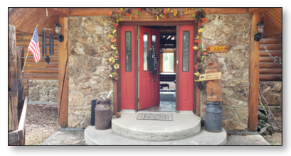
A tribute and a memorial, to some of the finest people I have ever known, I wrote this post for the remarkable memories I have associated with a wonderful getaway. Don't miss my tribute, in the top comment, to Lynn Finney. Without whom, none of this would be ... |
 |
Travelogue 7: Back in Time at Spirit West River Lodge
Ever desire to be transported back in time? Where in our minds and imaginations life was better? Seeking just such a place in our "new normal" post-COVID world, we were blessed to find it! Come "walk with me" through this doorway ... |
 |
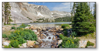
Travelogue 6: Snowy Range Scenic Byway in Wyoming! 🌄 One of the few places in the West where I had never spent any time whatsoever, we were very pleasantly surprised by the Snowy Range Scenic Byway. Like seeing my wife's first mountain lion! |
 |
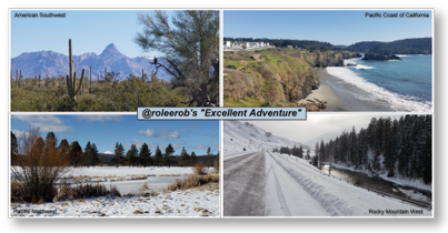
R2R Travelogue: Recap of "@roleerob's excellent adventure!" In winter ... A recap of my "Road to Recovery" trip of a lifetime. In 31 days, I drove 4,984 miles through a part of 8 states - Colorado, Arizona, California, Oregon, Washington, Idaho, Montana, and Wyoming. Unforgettable memories relived and new ones made! |

Check out HaveYouBeenHere's:
App • Map • Hive Travel Community • Discord


