Good time of day, depending on the time on your watch.
It's a sunny day on my watch right now, and I'd like to say the words of a classic: "It's been a long time since I've picked up checkers." I want to say that I haven't written about my travels for a long time.
Today I want to tell you about my car trip towards Volokolamsk. This is a city about 100 km west of Moscow.
I started this journey on the morning of April 25, 2025, and arrived at the place on April 26 at about noon. Of course, I could have covered the whole journey in one day, but it was an educational trip.
I usually make a similar trip with a stop in the city of Makaryev in the Kostroma region. My mother-in-law lives there.
I leave the house at 3 a.m., cover 450 km, and arrive at the place at 8 a.m. During the day, I help my beloved mother-in-law with her household chores. She turned 84 this year. This segment of the journey is nothing interesting. But this time I had to take a detour through the city of Sovetsk, because a bridge broke down on the Moloma River on the short road through Kotelnich. Это увеличило дистанцию на 120 км.
I want to tell you about the Makaryev-Volokolamsk road. I had a choice - to go through Yaroslavl or Vladimir. I chose the first option. This is not the shortest way. I chose it with the intention of driving through the city of Dmitrov, which is located 65 km north of Moscow. I wanted to see this ancient city. I did not regret my decision and saw a lot of interesting things during this trip.
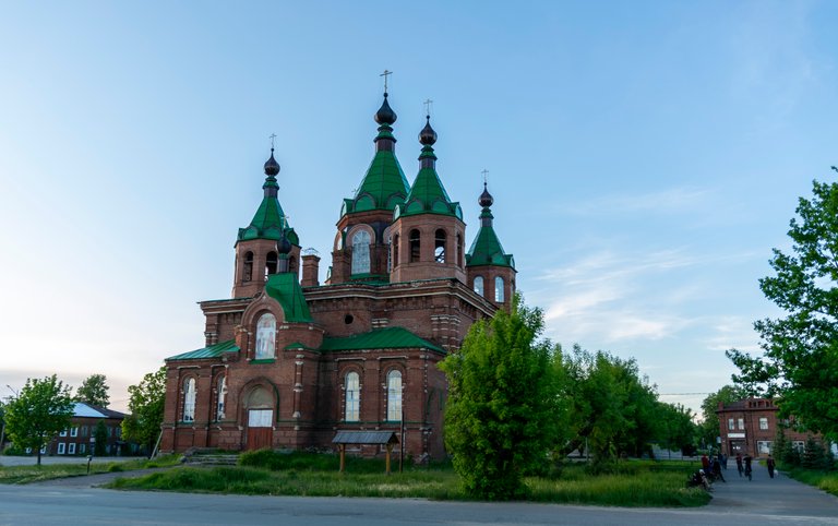
Makaryev is an ancient city and its official date of birth is 1439. There is a Makarievo-Unzhensky monastery in this city, but the central place of the city is occupied by the Cathedral of the Tikhvin Icon of the Mother of God (Alexander Nevsky).
But the review of this small town is a separate topic.
So, I got in the car and set off at about 2:30 a.m. Why do I choose this time? It's light at this time in summer, and at the end of April it gets light in about an hour. The road is almost empty because heavy trucks are parked in the parking lots. Some kind of law has been passed prohibiting drivers from driving more than 8 hours a day.
Why does the Kirov-Makaryev segment seem boring to me? The road runs almost everywhere outside of populated areas, because it began to be built only in the late 80s of the last century.
On the way to Kostroma, you can see the old church in the city of Suzdal from the road.
My task is to drive across the bridge in Kostroma across the Volga River without stopping. I have the impression that this bridge has been under repair non-stop since at least 2017, when I drove along it for the first time and stood in a traffic jam for almost 2 hours. A night to help me!
After driving about 360 km near the village of Govyrino, I turn off the M-8 highway (Yaroslavskoye highway) to the north on a road of regional importance. The interesting part of my journey begins.
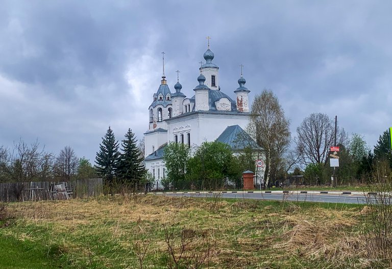
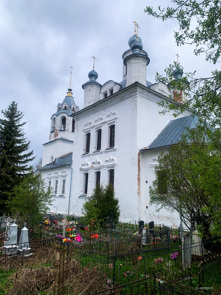
The village of Troitskoye. I made a stop at this church. There is a cemetery right next to it. The gates to the church grounds were closed due to the early hours. I took a couple of photos, stretched my legs, which were stiff from riding, and went on my way.
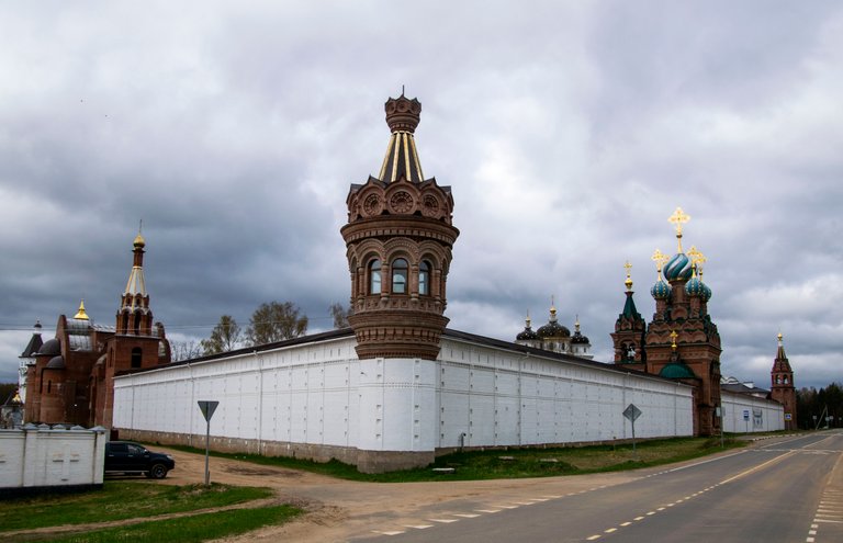
What's it? I didn't expect to see such a structure on this road. To be honest, I didn't expect anything like this from this road. I assumed that I would come across rural churches and nothing more.
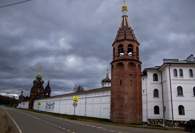
This is the Nikolo-Solbinsky Monastery. Accordingly, the settlement is called Solbino. Later, when I studied the map, I saw that each tower of this monastery bears its name, as if it were the Moscow Kremlin, and not a rural hinterland.
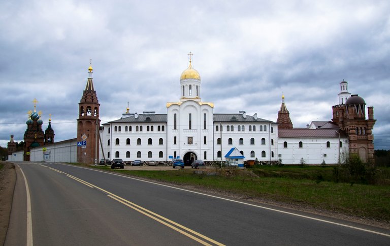
There are cars and people walking at the main entrance to the monastery. By the way, the central entrance is St. Nicholas Church, the St. Nicholas Bell Tower is located near the road, and the Alexander Nevsky Tower is on the right.
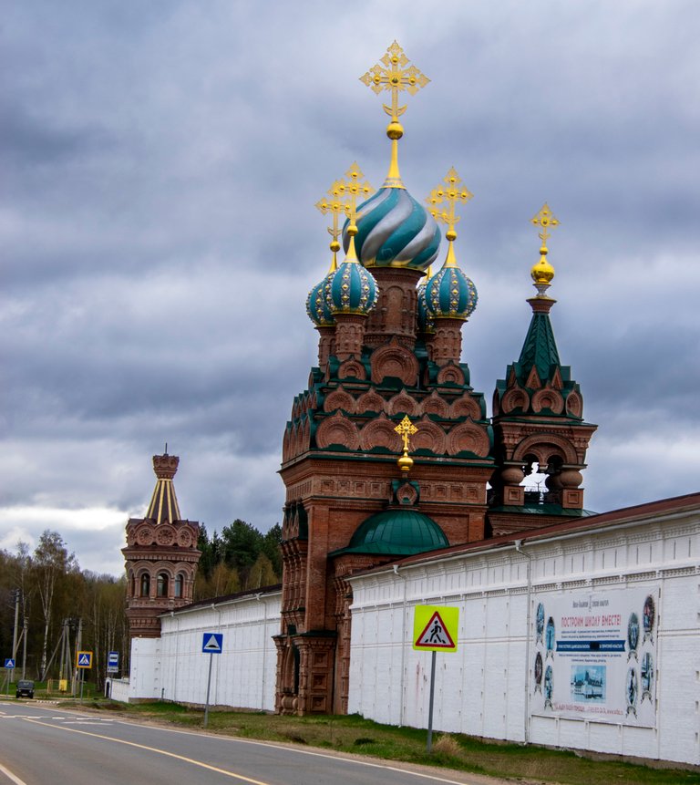
This is the Church of St. Spyridon. Next on the corner is the Peter and Paul Tower.
I continue on my way.
I missed an earlier stop at the church in the village of Rakhmanovo. I want to say that naturally I didn't stop at every church, but only at somewhere there was a convenient place to stop.
Most of the churches were located right next to the road and there was no way to make a short stop and take pictures of an interesting object. There is a simple explanation for this. When churches were built, there was usually free space next to them or other church buildings that were demolished during the Soviet era, and the road was laid in a convenient place, without thinking that someday the churches would begin to rebuild and continue their functions.

Here is a good example. There is a church in the distance, and the highway goes straight to this church. This photo was taken in July last year, when I was driving straight to Moscow and did not turn anywhere.
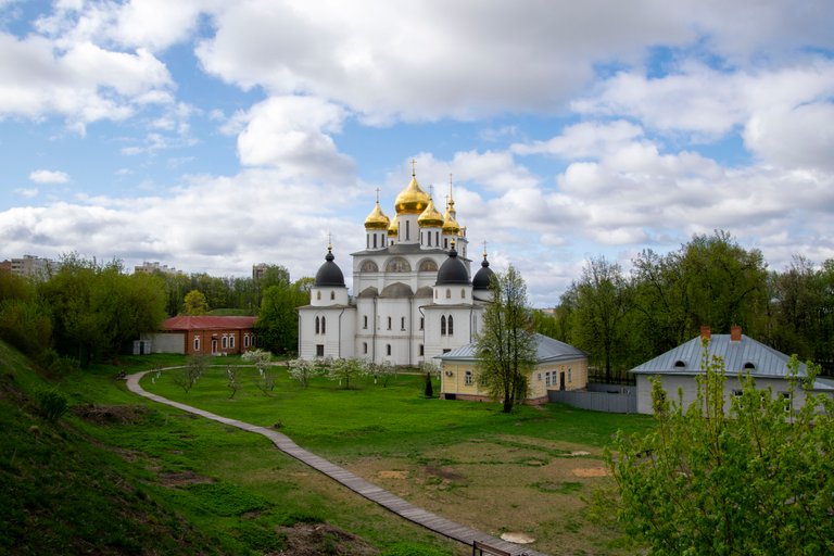
That's the purpose of my trip. I wanted to see the Dmitrov Kremlin or, more precisely, what was once the Kremlin.
Currently, the Assumption Cathedral stands in the central part. Instead of the fortress wall, there is currently only a high earthen rampart, from which I took this photo.
An attentive reader may have noticed that in all the previous photos the sky is gray. Yes, at some point along the way, I got caught in the rain and even a little snow. Dmitrov pleased me with a cheerful sky. I think I will write about a short walk around this city separately.
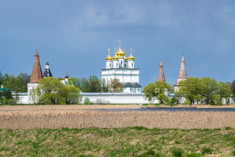
I'm almost there. What's it? This is the Holy Dormition Iosifo-Volotsky Stavropol Monastery. For some reason, I mistakenly decided that this was the Volokolamsk Kremlin, but the thought that I was mistaken did not leave me until that day. I looked at the map in more detail, and then the puzzle took shape in my head.
Again, each tower has its own name. But I am no longer surprised that the central cathedral is called the Assumption Cathedral.
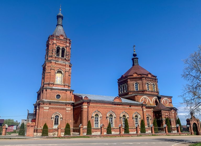
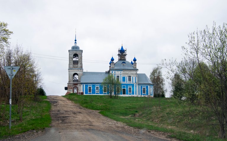
The village of Suvorovo, the Church of the Nativity of the Virgin. It was my last stop on the way.
I drove about 1400 km in one direction.
I went back on May 4 in the evening. The first half of the journey home was not very comfortable this time. It was raining all the way, and it was a big hindrance.
My next such trip is planned for the middle of July. I think that I will not go alone, if the stars are right, then my wife will go with me.

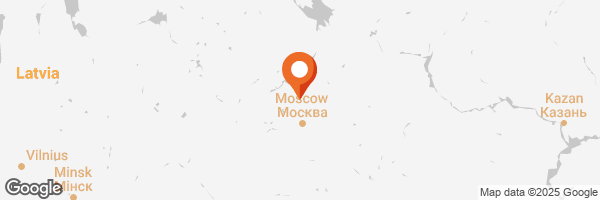
By the way, the location of the village can be seen by clicking on the link to the map in the comments to the article by @travelfeed and @pinmapple


Thanks for reading...
Text & Photography by @apnigrich
With love @apnigrich
Good luck and have fun


