English version
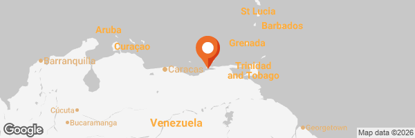
The Manzanares River is the most important freshwater waterway in Sucre State; it is approximately 81 kilometers long, which gives an idea of its magnitude. It originates in the imposing Cerro Turimiquire, flows through the city of Cumana, and empties into the Caribbean Sea via the Gulf of Cariaco.

In the not-too-distant past, its waters were crystal clear along most of its course, but now, as a discharge point for sewage, pollution has wreaked havoc on the stretch that runs through Cumaná. Currently, its flow has decreased because the municipality is dredging it; following a major emergency in which the main transfer line of the system that supplies water to the city collapsed, the decision was made to use water from the Manzanares River, previously treated by water treatment plants.


Once again, the importance of the Manzanares River to Cumana is evident; this waterway has inspired various artistic expressions such as songs, paintings, poems, and stories. Over the years, it has been a source of both joy and sorrow, which is why—and for many other reasons—it stands as a historical landmark. One of the most iconic songs is “River Manzanares” by José Antonio Lopez, which has become almost an anthem at the local level.


Although part of the river is still navigable, pollution levels have contributed to the decline in small boats; at least in Cumana, very few are now seen near the Market and the neighborhoods of La Trinidad and Las Palomas, through which the Manzanares flows until it reaches the river mouth, known as the city’s fishing pier.


This river has been a faithful witness to the past and to history; it was vital to the founding of Cumaná because it became the source of fresh water for the first settlers who established themselves in the San Francisco area, next to the Castle and the Basilica of Santa Inés. The old aqueduct was built from the Manzanares River and inaugurated in the early 1800s, serving as one of the foundations for development from the colonial era onward.


The images I’m showing you today are from a walk through the city center, right across the bridge connecting Mariño Street with Ayacucho Square. The river can be seen from various parts of downtown, with Guaiqueri Park, the Gómez Rubio Bridge, the Guzman Blanco Bridge, and Petión Avenue being the best spots to view it as it winds through the city.
Versión en Español
En tiempos algo remotos, era cristalino en la mayor parte de su recorrido, pero ahora, al ser desahogo de aguas servidas, la contaminación ha hecho estragos en el tramo que recorre Cumaná. Actualmente su caudal ha descendido debido a que la municipalidad lo está dragando ya que ante una gran contingencia, se derrumbó el eje transvase del sistema que surte de agua a la ciudad, se ha optado por utilizar el agua del Manzanares, previamente tratada por plantas de potabilización.
De nuevo se demuestra la importancia del río Manzanares para Cumaná, caudal que ha sido inspiración para diversas manifestaciones artísticas tales como canciones, pinturas, poemas y narraciones. A lo largo de los años ha sido motivo de alegrías y tristezas, por eso y más es un referente histórico. Uno de los temas musicales más emblemáticos es "Río Manzanares" de José Antonio López, casi un himno a nivel local.
Si bien una parte del río todavía es navegable, el nivel de contaminación ha contribuido a que las pequeñas embarcaciones cada vez sean menos vistas, al menos en Cumaná son muy pocas las que se observan ahora cerca del Mercado y los barrios La Trinidad y Las Palomas, por donde el Manzanares tiene su paso hasta llegar a la Boca del río, conocido como el muelle pesquero de la ciudad.
Este río ha sido testigo fiel del pasado y de la historia, fue vital para la fundación de Cumaná porque llegó a ser la fuente de agua dulce para estos primeros pobladores que se instalaron en la zona de San Francisco, al lado del Castillo, y de la Basílica de Santa Inés. El acueducto viejo fue construido a partir del Manzanares e inaugurado a principios de 1800, una de las bases para el desarrollo a partir de la época colonial.
Las imágenes que hoy les muestro son de una caminata por el centro de la ciudad, justo por el puente que comunica la calle Mariño con la Plaza Ayacucho. Desde varios sectores del centro se puede observar el río siendo el parque Guaiqueri, el puente Gómez Rubio, el puente Guzmán Blanco y la avenida Petión los puntos preferidos para contemplarlo en su recorrido por la ciudad.
✓Photos from my personal gallery, edited with Fotocollage.
✓Text translated with DeepL.
✓Fotos de mi galería personal, editadas con Fotocollage.
✓Texto traducido con DeepL.