English version
I find rock formations fascinating, above all because behind them lie millions of years of a place’s geological evolution. When we delve deeper into their study, we realize that the shapes, composition, and relief of the mountains reflect various natural processes.


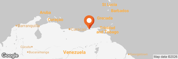
In this regard, Mount Tocuchare, located along Troncal Highway 9—the road to Marigüitar—rises before us as part of the Cordillera de la Costa mountain range. It is covered in dense vegetation—perhaps its most striking feature—and under certain conditions, it seems to merge with the sea. However, I didn’t want to limit myself to the view from the beach, so I decided to walk along the highway to get a different, closer perspective of this great mountain.


This mountainous area is home to xerophytic plants and trees of various sizes, where shades of green blend together to create a truly enchanting view. During this trip, I also noticed several houses located near the road; it is customary to build in these spots to take advantage of the visibility and thus sell fish, fruit, shellfish, sweets, handicrafts, condiments, vegetables, and other products to travelers who must slow down due to the proximity of a school zone and the entrance to a community.


Thus, both the beach and the mountains serve to provide for the area’s residents and also as a source of livelihood from a commercial standpoint. During this visit, I observed fruit trees but no flowering trees, indicating that planting is focused on productivity rather than ornamentation. At a glance, I could see crops of Oro-Miel pineapples, topocho and cuyaco bananas, plantains, and native lemons.


Versión en Español
Las formaciones rocosas me parecen fascinantes, sobre todo, porque detrás de ellas hay millones de años invertidos en la evolución geológica de un lugar. Cuando profundizamos en su estudio, nos damos cuenta que las formas, constitución y relieve de las montañas dan cuenta de diversos procesos naturales.
En tal sentido, el cerro Tocuchare, ubicado en la carretera Troncal 9, que es la vía hacia Marigüitar, aparece frente a nosotros formando parte de la Cordillera de la Costa. Luce una tupida vegetación, quizás su característica más resaltante, y bajo ciertas circunstancias parece fundirse con el mar. Sin embargo, no solo quise quedarme con la vista proporcionada desde la playa, así que decidí caminar por la zona de la carretera y tener una perspectiva distinta y más cercana de esta gran montaña.
Esta formación montañosa cuenta con plantas xerófilas y árboles de diferentes tamaños, donde las tonalidades de verde se entremezclan ofreciendo un panorama visual muy encantador. En este recorrido también observé varias casas ubicadas cerca de la carretera, es costumbre construir en estos lugares para aprovechar la visibilidad y de esta forma vender pescados, frutas, moluscos, dulces, artesanías, picantes, hortalizas y demás productos a los viajeros que deben reducir la velocidad debido a la proximidad de una zona escolar y la entrada a una comunidad.
Así que tanto la playa como la montaña sirven para alimentar a los residentes de la zona y también como sustento desde el punto de vista comercial. En esta visita constaté la presencia de árboles frutales pero no florales, así que la siembra está orientada hacia lo productivo y no hacia lo ornamental. A simple vista pude apreciar cosechas de piña Oro-Miel, los cambures topocho y cuyaco, plátanos y limón criollo.
✓Photos from my personal gallery, edited with Fotocollage.
✓Text translated with DeepL.
⛰️⛰️⛰️⛰️⛰️⛰️
✓Fotos de mi galería personal, editadas con Fotocollage.
✓Texto traducido con DeepL.
Posted Using INLEO