Hochwasser in Regen
English °
Deutsch °

We were in Bodenmais in the Bavarian Forest shortly after the New Year.
If you stay in a hotel there or, like us, on a campsite, you get a tourist ticket for the Bavarian Forest.
So we got on the train and traveled from Bodenmais to Regen.
I hadn't seen the town before and it probably wouldn't have been on my to-do list. But if we could get there for free, then that's what we did.
At that time, there was a risk of flooding everywhere in Germany. All the rivers in Bavaria were swollen to their limits.
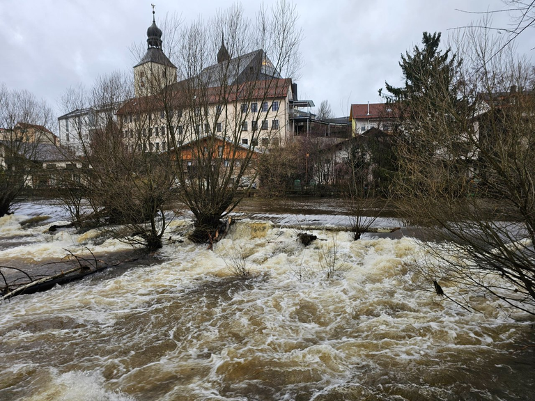
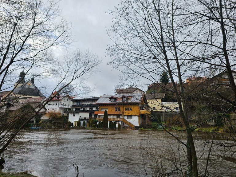
That was the case in Regen. The river there flows through, no wonder, Regen. Or rather the Black Rain. This eventually becomes the river Regen and is a tributary of the Danube.
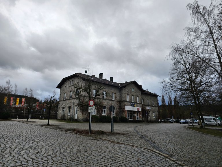
Arriving by train, you first stand at the station.
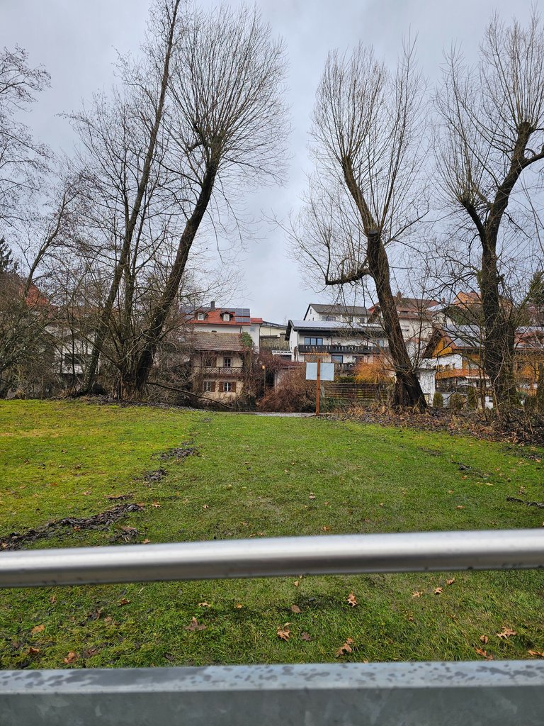
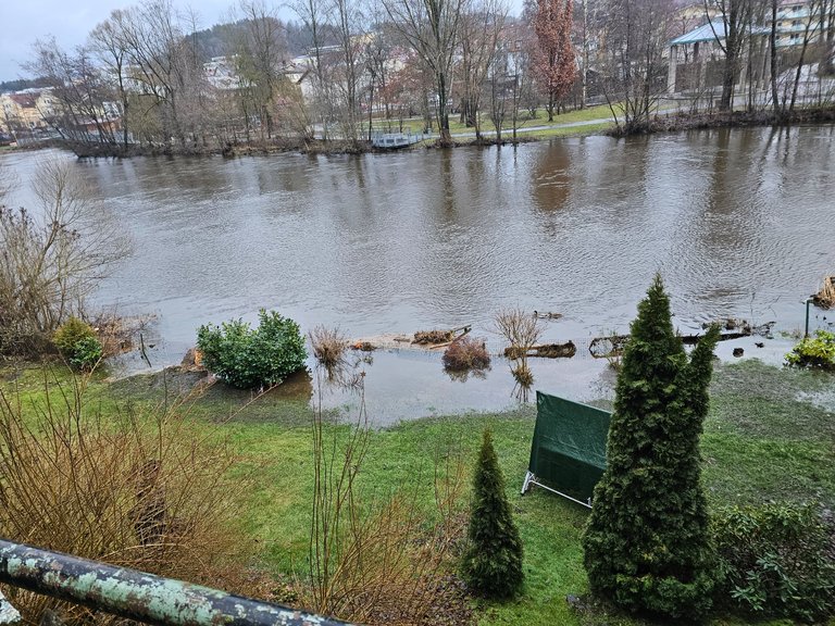
Not far away, about one kilometer, you come to the river Regen and the park that belongs to it.
We could already see from a distance that it was well filled.

The bridges weren't flooded yet, but they were close.
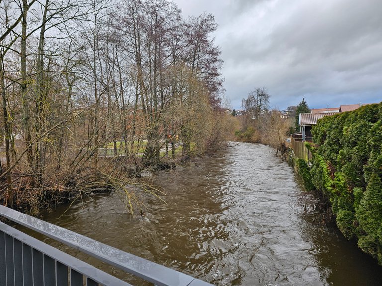
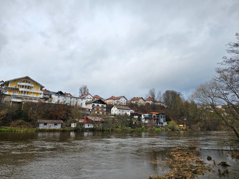
Things looked a little different on the other side of the river. Here a private house is built directly on the river. I can imagine that this would normally be a perfect place to live. Probably even with direct access to the water.
Ok, they have that now, but not the way they wanted.
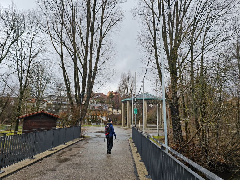
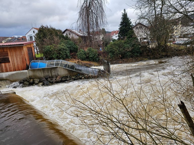
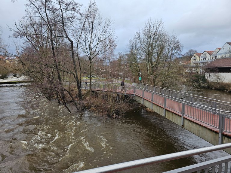
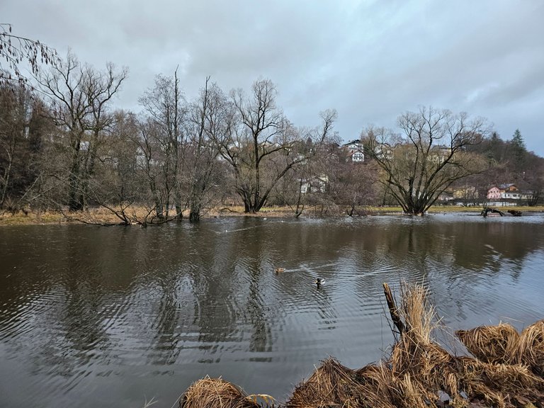
The park is located between the river Regen and a canal. The area in between is about as long as a soccer pitch.
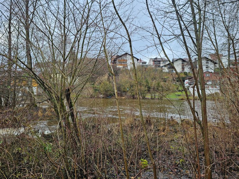
The canal was previously drained and equipped with a power station. It was already halfway under water.
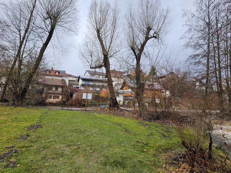
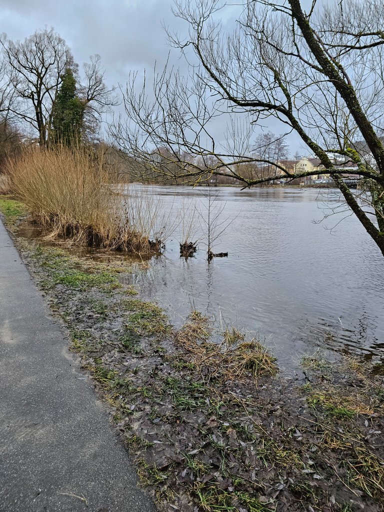
Here you can clearly see that the river probably overflowed a few days ago. In fact, my location for the photo is below the water surface.
You can still see the remains of the overflowed water on the lawn.
Just a few meters away, this was still in full swing. Actually, these bushes are not in the middle of the river. But at that time they were washed over with full force.

It was really cool to see this elemental force up close.
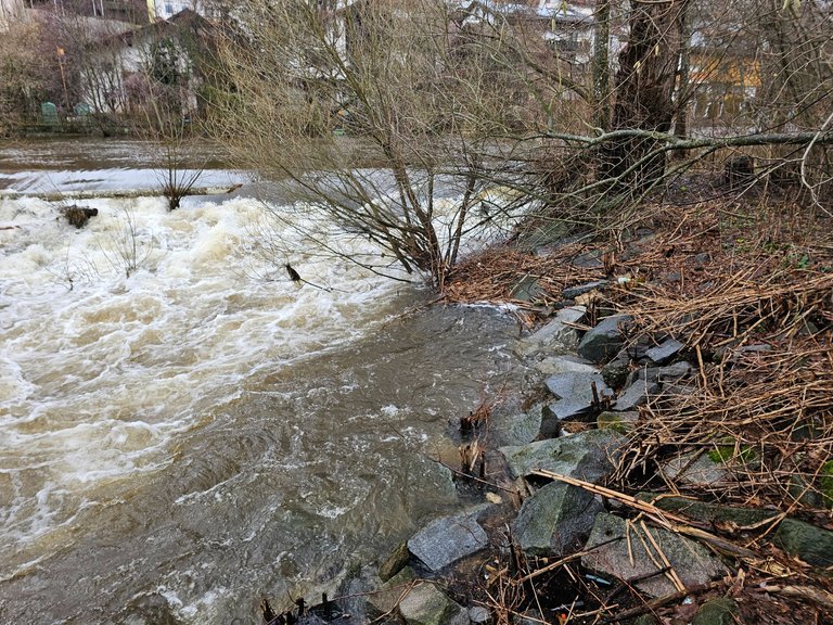
Don't forget, about 20 meters to the left behind my location, the canal was moving with similar force.
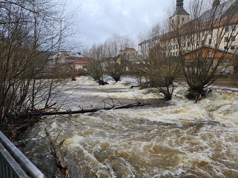
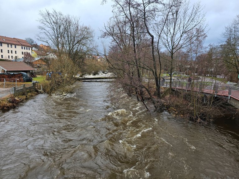
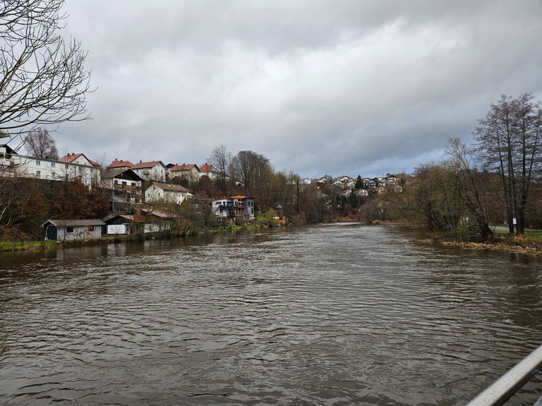
Here the two watercourses flow together again.
But the local residents took it very calmly. At least the one we spoke to did. I don't think she had a house directly on the river, though.
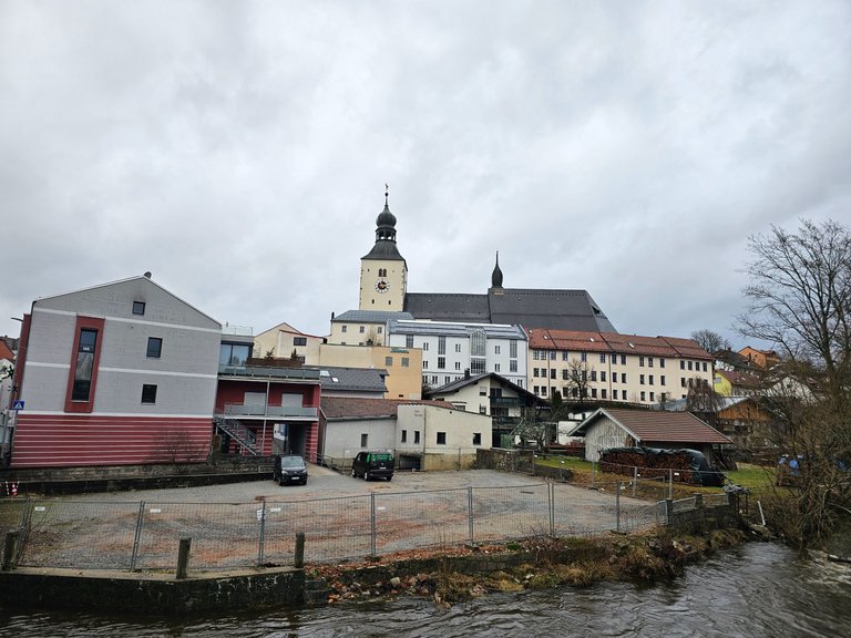
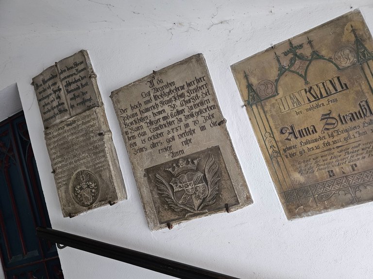
We also had a quick look around the old town. This is the market square.
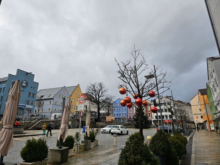
There wasn't really much there to make us stay longer. These plaques were still worth a photo.
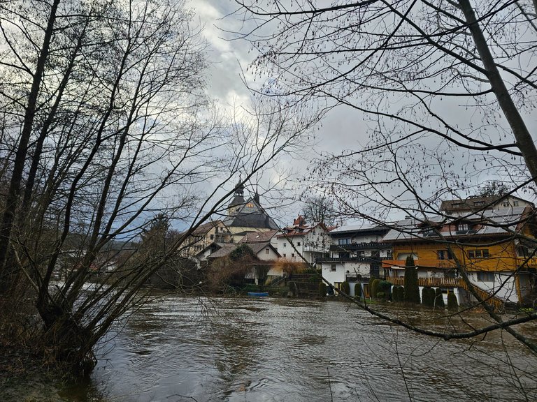
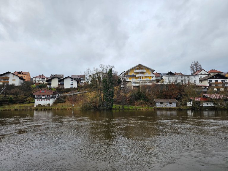
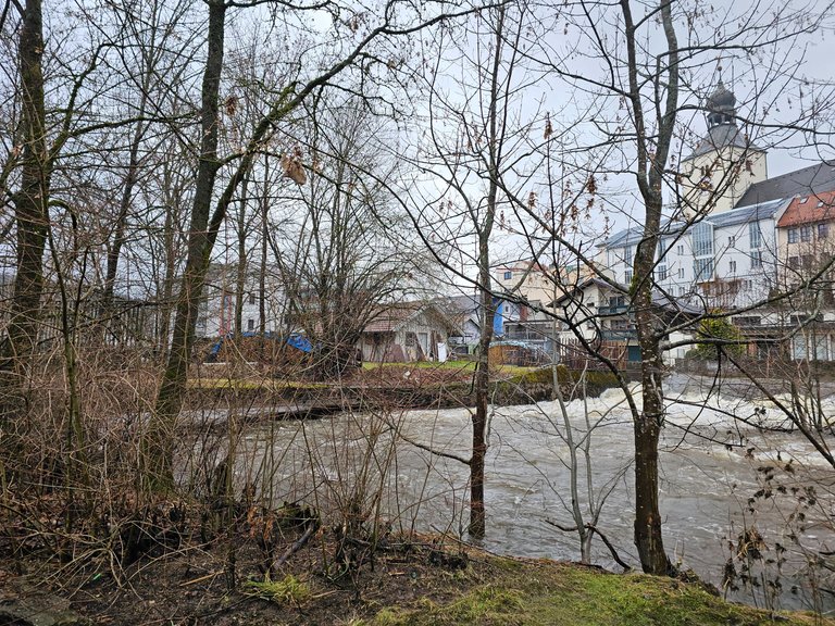
This is the other side of the shore. A few pictures earlier, I was standing right in the middle by the blue pavilion.
And this is the house from the pictures above. The garden is not really dry anymore.
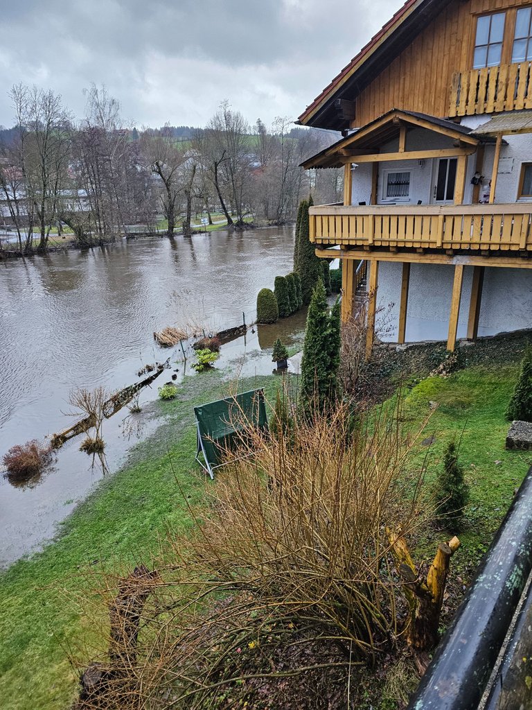
And the footpath is close to the edge.
The ducks had a lot of fun. There's not normally that much space to swim here.

Wir waren kurz nach Neujahr im Bayerischen Wald in Bodenmais.
Wenn man dort in einem Hotel oder wie bei uns, auf einem Campingplatz übernachtet, bekommt man ein Touristenticket für den bayerischen Wald dazu.
Also haben wir uns in den Zug gesetzt und sind von Bodenmais nach Regen gefahren.
Die Stadt kannte ich bisher nicht und wäre wohl auch nicht auf meiner to-do Liste gewesen. Aber wenn wir schon umsonst da hinkommen konnten, dann haben wir das auch gemacht.
Zu dieser Zeit war überall in Deutschland Hochwasser Gefahr. Alle Flüsse sind in Bayern bis an die Grenzen angeschwollen.
Das traf auf in Regen zu. Dort fließt der Fluß, wen wunderts, Regen durch. Beziehungsweise der Schwarzer Regen. Dieser wird irgenwann zum Fluß Regen und ist ein Zufluss der Donau.
Mit der Bahn angekommen, steht man erstmal am Bahnhof.
Nicht weit entfernt, ca. einen Kilometer, kommt man an den Fluss Regen und dem Park der dazu gehört.
Wir konnten schon in etwas Entfernung erkennen, dass dieser gut gefüllt war.
Die Brücken waren zwar noch nicht überschwemmt, aber knapp dran.
Auf der anderen Uferseite sah das schon etwas anders aus. Hier ist ein privates Haus direkt am Fluss gebaut. Ich kann mir schon vorstellen, dass das normalerweise ein perfekter Ort zum leben ist. Wahrscheinlich sogar mit einem direkten Einstieg zum Wasser.
Ok, den haben sie jetzt auch, aber nicht so wie gewollt.
Der Park liegt zwischen dem Fluss Regen und einem Kanal. Die Zwischenfläche ist ungefähr so lang wie ein Fußballfeld lang ist.
Der Kanal ist vorher abgeleitet und mit einem Kraftwerk versehen. Das stand schon halbwegs unter Wasser.
Hier kann man gut erkennen, dass der Fluss wohl schon vor ein paar Tagen über getreten ist. Tatsächlich ist mein Standort für das Foto unterhalb der Wasseroberfläche.
Auf dem Rasen sieht man die Überreste des übergetretenen Wassers noch.
Nur ein paar Meter weiter, war das noch voll im Gange. Eigentlich stehen diese Büsche nicht mitten im Fluss. Zu dem Zeitpunkt wurden sie aber mit voller Wucht umspült.
Es war schon krass, diese Urgewalt von Nah zu sehen.
Man darf nicht vergessen, links hinter meinem Standort ungefähr 20 Meter weiter, war der Kanal mit ähnlicher Kraft unterwegs.
Hier fließen die zwei Gewässer wieder zusammen.
Die Anwohner haben das aber sehr gelassen genommen. Zumindest die eine, mit der wir gesprochen haben. Ich denke aber, sie hatte kein Haus direkt am Fluß.
Wir haben uns auch kurz in der Altstadt umgesehen. Das hier ist der Marktplatz.
Es gab nicht wirklich viel dort, was uns zu einem längeren Aufenthalt bewegt hätte. Diese Tafeln waren noch ein Foto wert.
Das hier ist die andere Seite des Ufers. Ein paar Bilder vorher, stand ich genau in er Mitte bei dem blauen Pavillion.
Und das hier ist das Haus von den Bildern oben. Der Garten ist nicht mehr wirklich trocken.
Und der Fußweg ist knapp an der Grenze.
Die Enten hatten dafür ihren Spaß. Soviel Platz zum schwimmen gibt es normalerweise hier nicht.